Sunday, June 10, 2018

Day 12 Kington to Hay on Wye

Summary of Day 12

24.93Km

6.56 Hours walking

564 mtrs Elevation Gain

Weather - Partly Cloudy 22 degrees

Today was supposed to be an easy day, but it dragged out into a long day with the sun shining on us for most of the day and little places to shelter. The path was good for walking and on 99.9 days out 100 in England it would be great walking.

The last 3 miles seemed to never end and when we made it to our b&b we just collapsed.

With the next walking day being a long one we decided to arrange for our bag to be transported to our hotel to save our energy for walking.

Saturday, June 9, 2018

Day 11 Knighten to Kington

Summary of Day 11

22.89 Km

7.19 Hours walking

731 Elevation Gain

Weather - Mainly sunny 22 degrees

Friday, June 8, 2018

Day 10 Newcastle on Clun to Knighton

An easy day today with only 2 relatively small hills.

We got some misty rain for about an hour today, but it remained warm. Only the second day with rain in 4 weeks of walking.

Summary of Day 10
13.44 Km
4.08 Hours walking
399 mtrs Elevation Gain
Weather - Overcast / Misty Rain - 18 degrees


Thursday, June 7, 2018

Day 9 Montgomery to Newcastle On Clum

Summary of Day 9
19.57 Km
6.39 Hours walking
610 mtrs Elevation Gain
Weather - Mostly Sunny - 19 degrees

Day 8 Welshpool to Montgomery

Summary of Day 8
16.31 Km
4.54 Hours walking
44 mtrs Elevation Gain
Weather - Mostly sunny - 22 degrees

Tuesday, June 5, 2018

Day 7 Four Crosses to Welshpool

Summary of Day 7
16.31 Km 
4.54 Hours walking
44 mtrs Elevation Gain
Weather - Mostly cloudy - 20 degrees

Day 6 Trefonen to Four Crosses

Summary of Day 6

15.39 Km Along the towpath.

4.49 Hours walking

226 mtrs Elevation Gain

Weather - Mostly cloudy - 22 degrees

Sunday, June 3, 2018

Day 5 Llangollan to Trefonen

Summary of Day 5

30.38 Km
8.39 Hours walking
718 mtrs Elevation Gain
Weather - Mostly sunny - 21 degrees


uuu


kkk


kkkk


kkkk

Saturday, June 2, 2018

Day 4 Our first rest day since arriving inthe UK

Summary of Day 4
6 Km Along the towpath.
2 Hours walking
0 mtrs Elevation Gain
Weather - Mostly cloudy - 20 degrees

Friday, June 1, 2018

Day 3 To Llangollen


Summary of Day 3

25.84 Km

7.44 Hours walking

643 mtrs Elevation Gain

Weather - Mostly cloudy 22 degrees
The forecast was for rain and thunderstorms, luckily it was wrong.

Thursday, May 31, 2018

Day 2 Rhaullt to Maeshafin


Summary of Day 2
27Km
8.45 Hours walking
1180 mtrs Elevation Gain
Forecast. / Mostly cloudy 22 degrees

We started the day with a steep climb out of Rhuallt and soon realised it was going to be a hard day. Unfortunately we couldn't get any lunch from the hotel so the only food was a chocolate bar we had bought yesterday.
The climbs just got bigger and longer as the day progressed.
When we thought we had almost conquered all the hills we realised there was another hill up to Jubilee Tower. We took the shortcut down from the tower to walk to our accommodation, which we thought was a 2.5 mile easy walk, which it was till we came to the last kilometre which was up a steep road. Exhausted and dehydrated we collapsed into our accommodation the Hafan Def.
After rent with water it was straight to the Miners Inn the tiny pub in the village where we enjoyed a chat with the publican ( who has recently sold the pub) and the locals. Another big day tomorrow, but not so many hills.


tttt


tttt


tttt


ttt

Wednesday, May 30, 2018

Day 1 Offas Dyke Walk - We are in Wales

Yesterday we travelled to Prestatyn in Wales for the start of the Offas Dyke Walk
It wasn't an easy day with a bus and 3 trains to tackle to get back across the UK.
And our experience with the train system in the UK was again tested.
We caught the bus to the station and our first train was listed on the board as on time, then late, then later, then cancelled. An hour and 15mins later we were on a train towards our destination, despite problems with connecting trains we made it to Prestatyn only an hour and half later than our original ETA.

Prestatyn is your typical UK beach town with lots of amusement park style activities, although it has a good stretch of sand rather than the pebble beaches found elsewhere.

We stayed at the Beaches Hotel a typical beach side hotel although slightly upmarket.

Today we sent our suitcase from the hotel to Chepstow and we would carry all our requirements for the next 2 weeks on our backs.

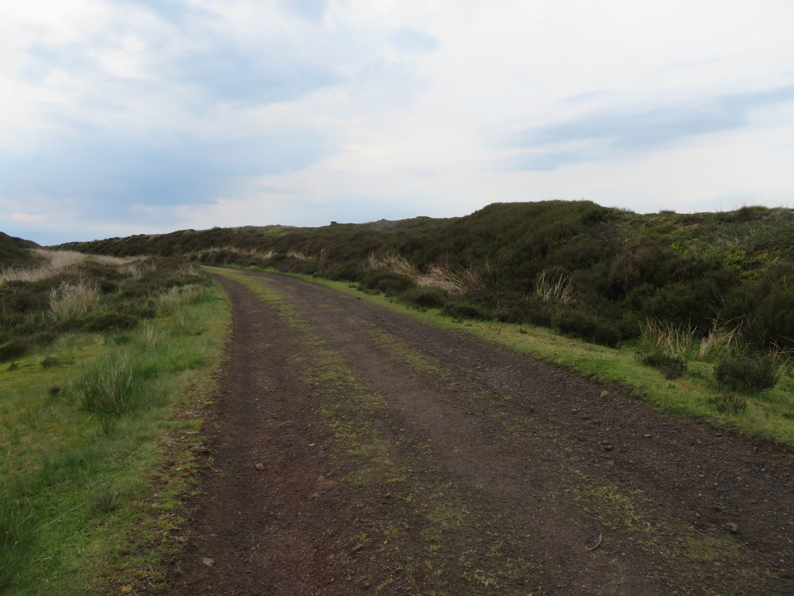
The first day took us from Prestatyn over the hills to Rhault, only 15km but a lot of uphill.

We arrived in Rhault and the rain started just after we made it to our hotel The White House (no sign of Trump in this White House)

Tomorrow is a big day 18 miles so its an early night and an early start, hopefully the rain will have cleared.


Summary of Day 1

14.72 Km
4.44 Hours walking
380 mtrs Elevation Gain
Forecast  Overcast / 20 degrees


ddd


ddd


A brief description of the Offa Dyle


ddd


The local fauna

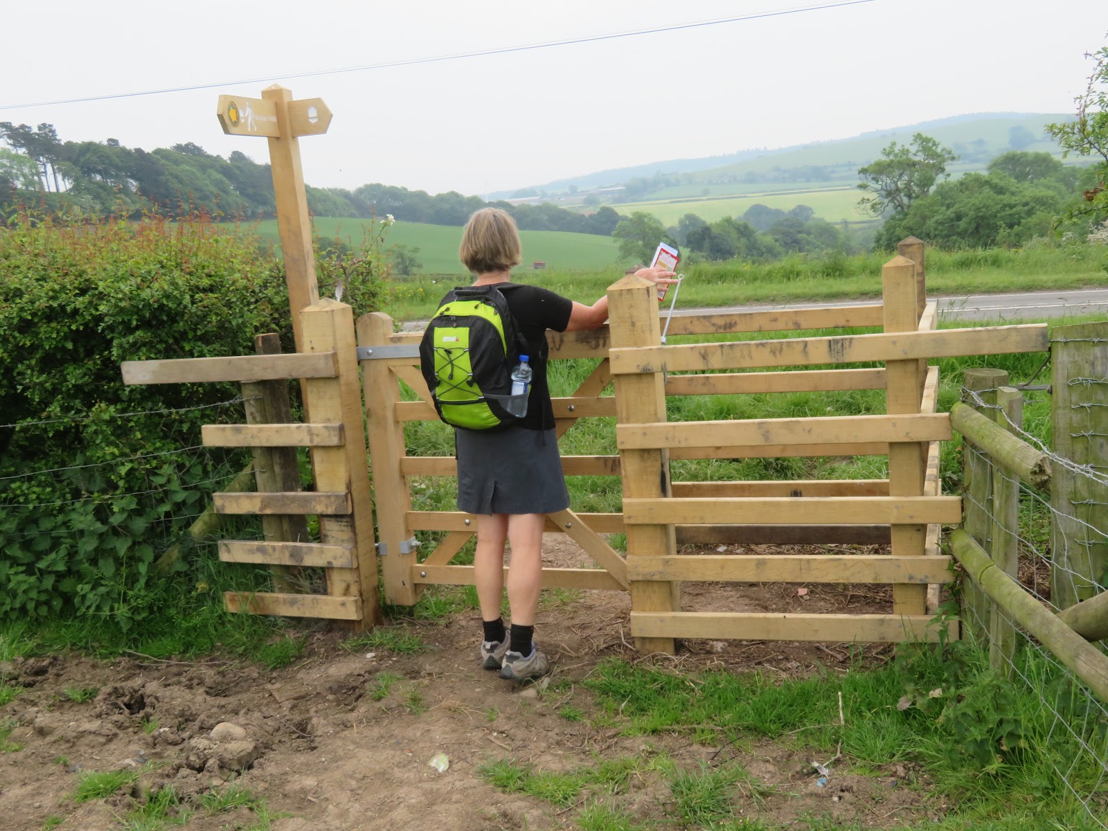
Money has been spent on the walk with
many new gates and sign posts.

From this seat the guide book say you can see Snowdonia and sometimes
Ireland - But not today

Karen enjoying the views over the fields for lunch


ddd

ddd

Monday, May 28, 2018

Day 15 Grosmont to Robin hoods Bay - The end (part 1)

Summary of Day 15
24.17Km
6.53 Hours walking
490 mtrs Elevation Gain
Forecast  Overcast Fog/ 14 degrees

Sunday, May 27, 2018

Day 14 Blakey Ridge to Grosmont -One Day To Go


Summary of Day 14

23.65Km
6 Hours walking
223 mtrs Elevation Gain
Forecast  Sunny / 18 degrees


ppp


ppp


ppp

Saturday, May 26, 2018

Day 13 Clay Bank Top to Blakey Ridge (Farndale East)

Easy and boring

Summary of Day 13

17.27Km
4.17 Hours walking
211 mtrs Elevation Gain
Forecast Cloudy / 15 degrees


Looking back on yesterdays track, I guess there were some great views to be had.
Looking forward a long and winding road and disused rail track into Blakey Ridge.


The local turf cricket pitch has some interesting obstacles, firstly sheep grazing on the pitch leaving their mark everywhere and secondly a distinct slop from right to left.

One of the ever present Grouse on the moors


eee


Our hotel in Farndale East

Our trusted guide book for the walk, along with the GPS we still managed to make a few wrong turns, but nothing too bad after day one's 4km extra walking.

eeee

Day 12 Danby Wiske to Clay Bank Top (Chopgate)

Longest day / Terrible weather
Summary of Day 12

36.62km
9.16 Hours walking
874 mtrs Elevation Gain
Forecast Rain  / 13 degrees

Today was always going to be a hard day, but not as hard as it turned out.
Rain started early in our walk and persisted for the rest of the walk, mostly light drenching rain.
Although the guide book said enjoy the views all we saw was fog, rain and the back of Karen or Clyde's head.

We have come 130 miles in perfect weather
That was about to change and on our longest day.


It all started off well as we crossed the fields

And the rail tracks
We were prepared for bad weather but were repeatedly told the weather as going to continue to be good/


Then the rains came


Followed by fog and winds as we climbed up the 600mtr

Not too many picture as our camera is not waterproof!

We were staying at the Buck Inn which was run by a German living in England with an Australian passport.
He picked us up at Clay Bank Top and drove us the 2 miles to Chop Gate, and returned us to the track in the morning.